- Description
- Specifications
- Shipping
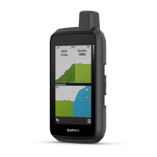
Garmin Montana 700
Rugged GPS Touchscreen Navigator
With routable mapping for roads and trails, the Montana 700 handheld brings advanced outdoor features into a sturdy 5” format that’s ideal for navigation on foot, bike, kayak, ATV, and more.
GENERAL
-
Physical dimensions: 3.4" x 7.2" x 1.3" (8.76 x 18.30 x 3.27 cm)
-
Touchscreen: Yes
-
Display size: 2.55"W x 4.25"H (6.48 x 10.80 cm); 5" diagonal (12.70 cm)
-
Display resolution: 480 x 800 pixels
-
Display type: WVGA transflective, dual orientation
-
Weight: 14.0 oz (397 g) with included lithium-ion battery pack
-
Battery type: Rechargeable lithium-ion (included) or 3 AA batteries (not included; lithium recommended)
-
Battery life:
• GPS Mode: up to 18 hours
• Expedition Mode: up to 330 hours -
Water rating: IPX7
-
MIL-STD-810: Yes (thermal, shock, water, vibration)
-
High-sensitivity receiver: Yes
-
Interface: High-speed micro USB and NMEA 0183 compatible
-
Memory/History: 16 GB (user space varies based on included mapping)
MAPS & MEMORY
-
Preloaded maps: Yes (TopoActive, by region; Federal Public Lands maps, U.S. only)
-
Ability to add maps
-
Basemap
-
Automatic routing (turn-by-turn on roads): Yes (with optional mapping)
-
Map segments: 15,000
-
BirdsEye: Yes (direct to device)
-
Detailed hydrographic features: Yes (coastlines, lake/river shorelines, wetlands, streams)
-
Searchable points of interest: Yes (parks, campgrounds, scenic lookouts, picnic sites)
-
Displays national, state, and local parks, forests, and wilderness areas
-
External memory storage: Yes (32 GB max microSD card)
-
Waypoints/Favorites/Locations: 10,000
-
Tracks: 250
-
Track log: 20,000 points, 250 saved GPX tracks, 300 saved FIT activities
-
Routes: 250 (250 points per route; 50 points auto routing)
-
RINEX logging: Yes
SENSORS
-
GPS
-
GLONASS
-
Galileo
-
Barometric altimeter
-
Compass: Yes (tilt-compensated 3-axis)
-
GPS compass (while moving): Yes
DAILY SMART FEATURES
-
Connect IQ (downloadable watch faces, data fields, widgets, apps)
-
Smart notifications on handheld
-
VIRB remote
-
Pairs with Garmin Connect Mobile
-
Active Weather
SAFETY & TRACKING
-
LiveTrack
OUTDOOR RECREATION
-
Point-to-point navigation
-
Compatible with BaseCamp
-
Area calculation
-
Hunt/Fish calendar
-
Sun and moon information
-
Xero locations
-
Geocaching-friendly: Yes (Geocache Live)
-
Custom maps compatible: Yes (500 custom map tiles)
-
Picture viewer
-
inReach remote widget
-
LED beacon flashlight
INREACH FEATURES
-
inReach remote compatible
OUTDOOR APPLICATIONS
-
Compatible with Garmin Explore app
-
Garmin Explore website compatible
-
Dog tracking: Yes (when paired with a compatible system)
CONNECTIONS
-
Wireless connectivity: Yes (Wi-Fi, Bluetooth, ANT+)